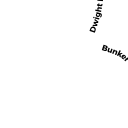
20 BUNKER CR
Owner Information
CHESEL LILY
20 BUNKER CR
EAST LONGMEADOW, MA 01028


Property Details
20 BUNKER CR is classified as a Developable Residential Land.
20 BUNKER CR is valued at $8,500. The land is valued at $8,500 and the structures are valued at $0.
This property is in Zone RB. Confirm with local Zoning Board authorities to ensure there are no overlays or other easements on this property.
The most recent deed for 20 BUNKER CR is recorded at the local registrar in Book 19980, Page 572. 20 BUNKER CR was last sold on Wednesday, August 21, 2013 for $1.
Assessment data from fiscal year 2019.
Flood Data
According to the FEMA National Flood Hazard Layer, this property does not appear to be in a flood zone. It may also be in an area not yet reviewed. Nonetheless, confirm this information prior to taking any action.
To view the flood hazards around this property, create a FEMA "Firmette" Map of the area around 20 BUNKER CR.
Broadband Internet Providers
| Provider | Type | Bandwidth (mbps) | |
|---|---|---|---|
| GCI Communication Corp. | Satellite | 0 | 0 |
| HughesNet | Satellite | 25 | 3 |
| VSAT Systems, LLC. | Satellite | 2 | 1 |
| Viasat Inc | Satellite | 100 | 3 |
| Verizon New England Inc. | DSL | 5 | 0 |
| Comcast | Cable | 1000 | 35 |
| Charter Communications Inc | Cable | 940 | 35 |
| T-Mobile | Fixed Wireless | 25 | 3 |
Broadband service provider data from December 2020.
Adjacent Properties
- 10 BUNKER CR
Developable Residential Land owned by CALABRESE ANTONIO - 27 BUNKER CR
Single Family Residential owned by PRESTE DAVID S + DOREEN J - 46 PUTTING GREEN CR
Single Family Residential owned by LADUKE VINCENT G - 34 PUTTING GREEN CR
Accessory Land with Improvement owned by PENNA STEPHEN A - FRANCONIA CR
Undevelopable Residential Land owned by HRDLICKA AMY B